We got up exceptionally early to leave for Nottingham. A nice train ride down there (though we had to change twice), we arrived. Google maps gave us horrendous directions to the hostel, so we ended up getting turned around (a theme for the weekend). We found the tourism office and got proper directions and found the hostel. It was pretty nice, very cheap, overall, a pretty good hostel. I'm becoming a hostel officianado!
Anyway, we walked toward the city centre first, as we noticed a giant ferris wheel on the way in. It was right in the middle of the city centre square, which happened to be hosting a regional farmer's market (of sorts). I get unreasonably excited about locally grown and produced food, so you'll just have to bear with me and endure the pictures. :o]
Some of the stalls at the regional farmer's market

Pedigree Longhorns, yeah!

Local game....care for some squirrel?
Or GOAT? No idea they had goats in Britian, lol.
Anyway, we decided to be tourists and do the ferris wheel thing. This was actually good, because we got to see all the places we wanted to visit from WAY up high.
The ferris wheel.
After the ferris wheel, we set off in search of Nottingham Castle. The former home of the Sheriff (Alan Rickman). Actually, there IS a Sheriff of Nottingham these days, but the position is entirely honorary. He doesn't actually hunt outlaws. Boo. Anyway, the Castle was pretty cool. The inside was actually contained an art museum, so it wasn't particularly historic, but it was cool nonetheless.Robin Hood!

Nice grounds at the Castle of Nottingham.
Springtime!!
Entrance to the Art Museum part of the castle.
Side of the Castle.
Next, we went to the city of caves, which is located, bizarrely, on the first level of the shopping center in Nottingham. Nottingham has an extensive cave system, handy for outlaws and all sorts of interesting people. In medieval times, it was used as an underground tannery. We got the ins and outs of all that went on (and in) while tanning hides back in 1400s. Not pretty, needless to say. In the 1940s, it was used as a giant air-raid shelter, which makes perfect sense. At full capacity, it could hold up to 30,000 people. After that, it was used as storage for local breweries. And after THAT, it was mostly filled in for the egregious shopping center.
Mockup of the air raid shelter.
Just a stray bomb in the caves. Don't worry, it not real. I think.
From the ferris wheel, we could see a large windmill in the opposite direction of the castle, so we headed that way. We got there (eventually) and walked around a little. It is actually a working wheat mill, and produces award winning organic flour. Also a science center attached too it. The former owner was a mathematician and discovered a theorem of some kind. We went all the way to the top, and I got two bags of the flour (not sure what I'm going to do with it yet...), which subsequently added about 6 pounds to my backpack.
Green's Mill from the road.
The Mill again.
It was getting dark at this point, so we headed back towards the city and the hostel. We grabbed some food, and then hung out in the lobby. We watched comedians on one girl's computer, we laughed the entire time. I introduced everyone to Eddie Izzard (You! Cake or death? Erm, I'll have the cake, please. Oh, all right then...) and I discovered the greatness that is John Pinnette (There was this one guy with us, Timmy. He was too skinny. Half way through the meal, he DIED.). Look both of them up on youtube if you've got time, they're great. And we all loved Dane Cook, who is world renown, apparently. After that, we crashed.
This morning, we got to the train station at 7:45 and headed north(ish) toward the little town of Edale, in Derbyshire. Derbyshire is home of the Peak District, which does not actually refer to the "peaks;" it refers to the ancient Pict tribe (Druids, I think?) that lived there way back when. Edale is the start of the Pennine Way, basically the British version of the Appalachian Trail. It's really long. While on the train, we noticed a lot of hard-core hikers (with hiking poles, etc), which made us wonder what we were getting ourselves into.
Don't let that blue sky fool you.
Anyway, we got of the train and headed towards the visitor's center (even a tiny town like Edale has a visitor's center). We found a guidebook that had a list of walks that were between 2 and 10 miles. We were slightly ambitious and decided to pursue a 6 mile hike. We did, after all, have all day. We did complete the hike, which we have to say, was VERY poorly marked. This caused us to backtrack quite a bit, adding about 3/4 mile to our journey. The big downer of the day, though, was the clouds and fog. We got on top of these huge hills/rises/what have you and couldn't see a thing. So my pictures aren't the greatest, but you'll probably get the idea.
The directions had us traipsing through sheep and cattle fields. This house is where I'm going to live in at some point. Just FYI.
Now that fog is more like what we saw all day.
We had to climb an assortment of fences.
After one hell of a climb, we arrived at the top. But we were not finished! The hike we chose took us across a series of moors, all of which ultimately led us to Mam Tor, a former bronze age settlement.
A heather covered moor. And a stray glove? Yeah, it was cold.
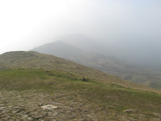
That's Mam Tor in the back. We still had a while to go at this point. We walked along the ridge line.
On top of Mam Tor. This is looking back on where we'd been already.
Finally made it to the top of Mam Tor. Please note the wind.
The path to Hollin's Cross. We crossed over at the lowest point on the ridge and descended into the Edale Valley, back to civilization.
Ooooooooh.
A decent picture of the Edale Valley, before we left the ridge.
Hi, sheep! There were a bunch nearly at the top of the moors. They're borderline feral sheep.
A bunch of lazy cows. We walked through their field.
Sheep! We walked through their field too.
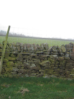
Rock fences everywhere.
Families, dogs, and muddy boots welcome. Excellent.


No comments:
Post a Comment